Map and positions
- 06 Oct 2021
- Print
- DarkLight
- Download PDF
Map and positions
- Updated on 06 Oct 2021
- Print
- DarkLight
- Download PDF
Article summary
Did you find this summary helpful?
Thank you for your feedback!
Position of the units
The platform shows you the last position of the units
When you log in, this interface appears on the screen, positioned on the menu  and on the first unit in the list.
If this is not the case, click on to display the list of unit positions
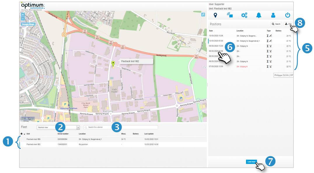
List of units and display filter
1. All your units appear in the list, sorted alphabetically or by appearance icon. You can change the display order by clicking on the "Unit" or "Serial Number" column.
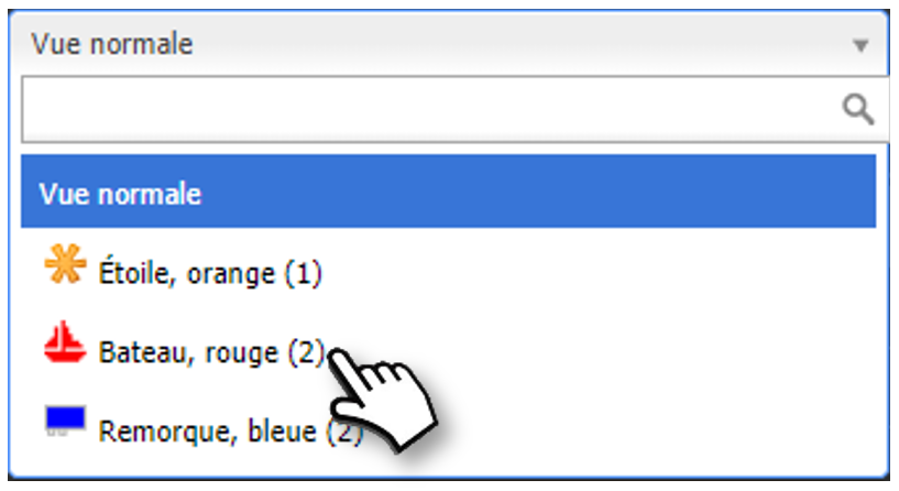
2. You can also filter the unit display and select only one group (same appearance icon). Click on the filter and select the desired group. The units concerned are displayed on the map.
3. You can also search for a unit in the list to display it.
4. The information displayed in the list is: unit name, serial number, last location address, last location temperature, battery level, last location time stamp.
List of positions of the selected tag
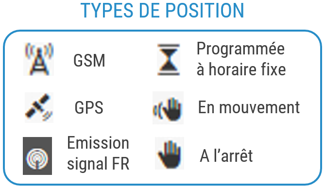
5. The position list contains the following information: position time stamp, address, position type (see below), battery level, temperature.
6. Click on a location to see the location on the map.
7. Click the button to view more locations. There is no limit to how long you can keep the data.
8. You can export the list of positions in .csv format.
Temperature display
10° (black): temperature (no alert configured)
If a temperature alert has been configured:
10° (green): normal temperature
9° (blue) : temperature too low
25° (red) : temperature too highExamples of displays
Display a group of units with the same appearance icon
The 2 beacons are in the same place:
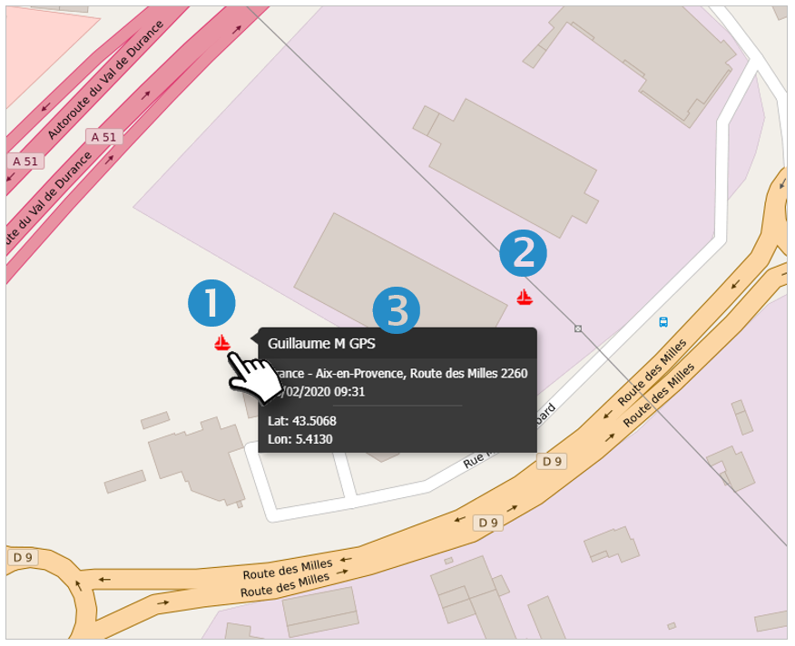
1. Beacon configured with GPS positioning
2. Beacon configured with GSM positioning (difference of 200m, variable depending on distance and power of GSM relay antennas)
3. Move the cursor over the beacon to show the details and its position)
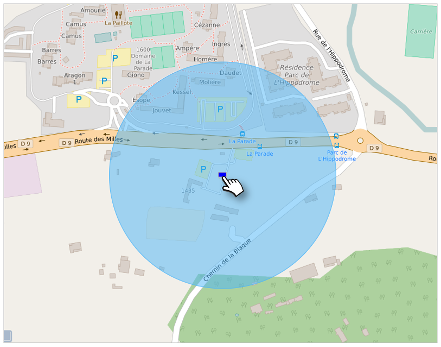
Display of a beacon configured in GSM
The position of the beacon is located within a radius whose size varies according to the distance and power of the GSM relay antennas (here: 250m diameter)
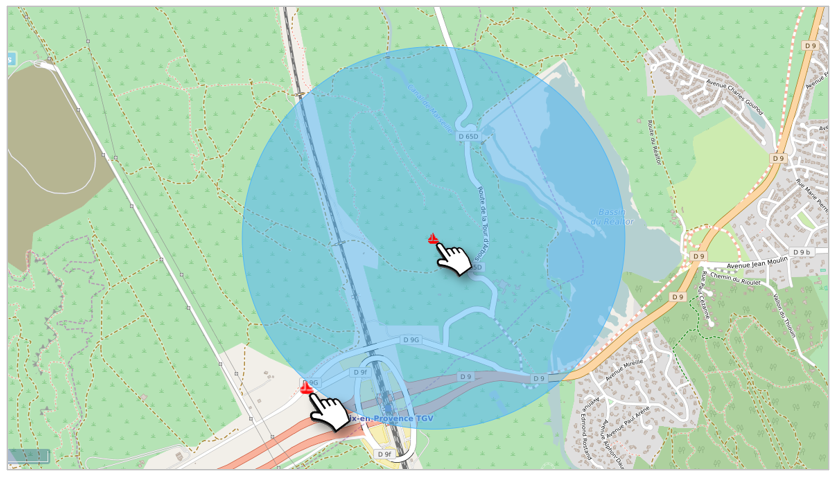
Display difference between a GSM position and a GPS position
The beacon is programmed in GSM, the beacon in GPS (here: distance of 600 m, rural area with few GSM antennas)
Attention !
It is possible that a beacon configured in GPS positioning  temporarily sends positions in GSM mode (less accurate):
The reason is that the beacon does not receive the GPS signal (indoor, in a building, a shed, a warehouse...) and automatically switches to GSM triangulation.
As soon as the beacon finds the GPS signal (outside), it will automatically transmit its GPS position again. Do not change the positioning mode
Was this article helpful?